Karst Assessments
Specialized karst evaluation for forestry and resource operations in limestone and marble terrain.
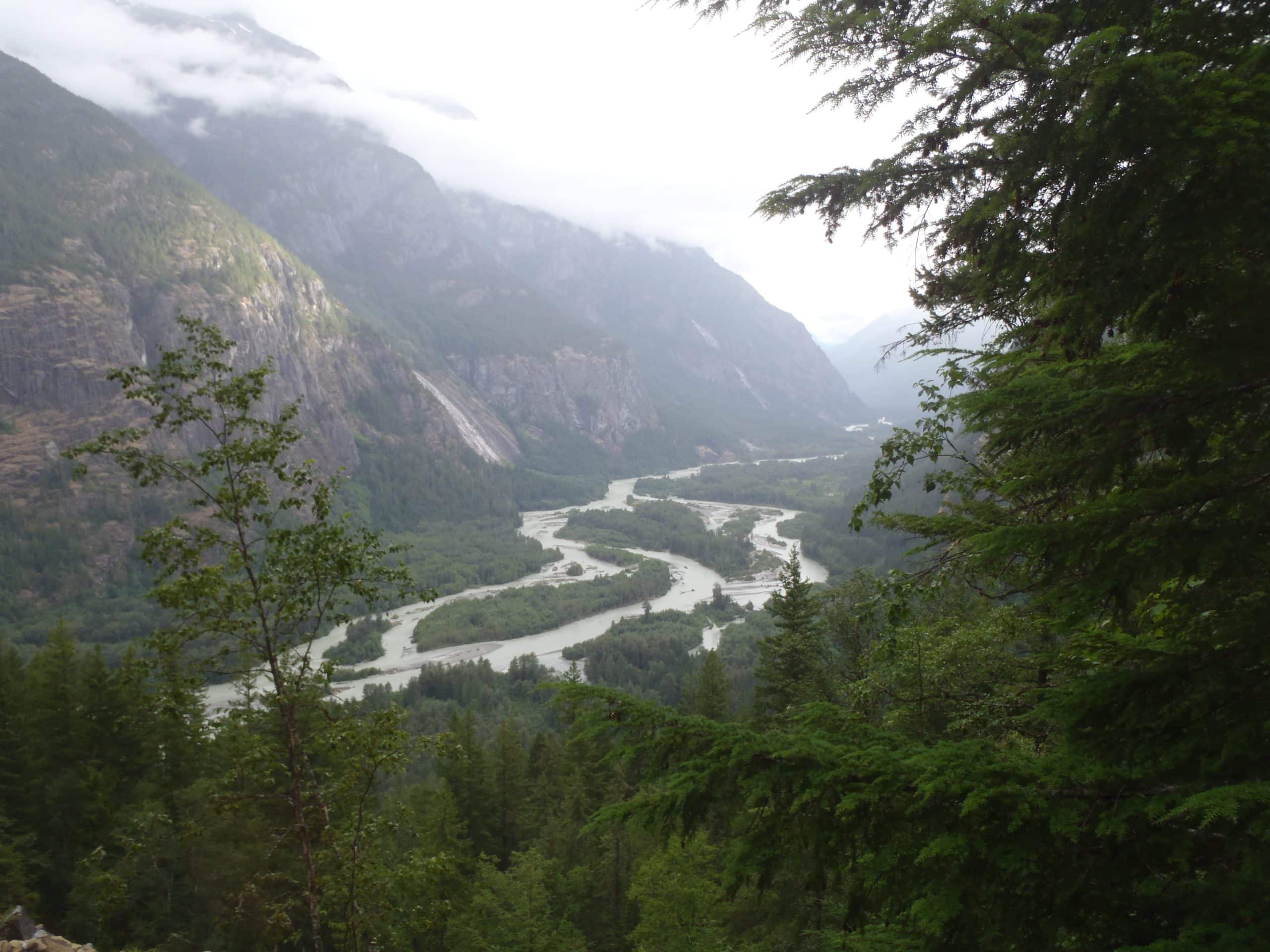
Forestry and resource activities in karst terrain require specialized assessments.
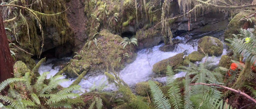
In limestone and marble environments, water moves through fissures, sinkholes, conduits, and underground void systems that are not visible at the surface. Surface disturbance can connect directly to subsurface groundwater systems, creating environmental sensitivity and safety risks that require specialized assessment.
Karst systems route water through fractures, sinkholes, conduits, and underground voids that are not visible from the surface. As a result, surface activities can directly affect groundwater systems, creating environmental sensitivities and safety risks that demand dedicated expertise.
Third Rock Geoscience provides site-specific Karst Field Assessments (KFA) to support responsible forestry and resource operations across British Columbia.
Third Rock Geoscience delivers site-specific Karst Field Assessments (KFA) to help licensees and resource operators work responsibly and confidently in British Columbia’s karst regions.
Karst is not a variation of terrain stability. It is its own discipline.
When Clients Call Us
Karst assessments are typically required when:
Awareness of karst sensitivity has increased significantly in recent years. Operators are expected to demonstrate that groundwater and void-related risks have been properly evaluated.
What Makes Karst Different
Karst risk is defined by four primary concerns:
Groundwater Vulnerability and Sediment Delivery
Surface water can enter the subsurface quickly through openings in carbonate bedrock.
Logging disturbance, ditching, road runoff, pollution, or sediment-laden flow can move directly into underground conduits and reservoirs. Once sediment enters the system, it can travel significant distances with limited natural filtration, alternating hydrology and degrading natural subsurface ecosystems and habitats.
Karst groundwater often supplies drinking water, supports fisheries, and maintains ecological stability. Once contaminated, it is extremely difficult to remediate.
Understanding how water enters, moves through, and exits the site is central to responsible karst management.
Soil Loss
Karst soils are thin, easily eroded, and slow to form, making them highly vulnerable to disturbance.
Harvesting increases exposure of mineral soil, which can lead to sediment transfer into subsurface karst systems.
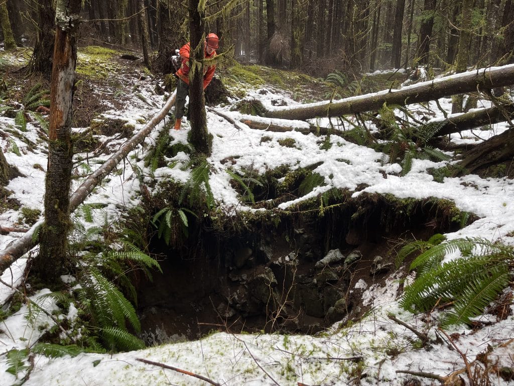
Void & Collapse Risk
Subsurface cavities may occur close to surface grade. Heavy equipment operating over shallow voids can trigger collapse of cave roofs or sinkholes, posing risks to workers and infrastructure.
Sinkhole collapse is a recognized hazard in karst, especially where soil bridges are thin and easily breached by machinery.
Identifying void-prone areas and adjusting operational constraints is essential for safe and sustainable development .
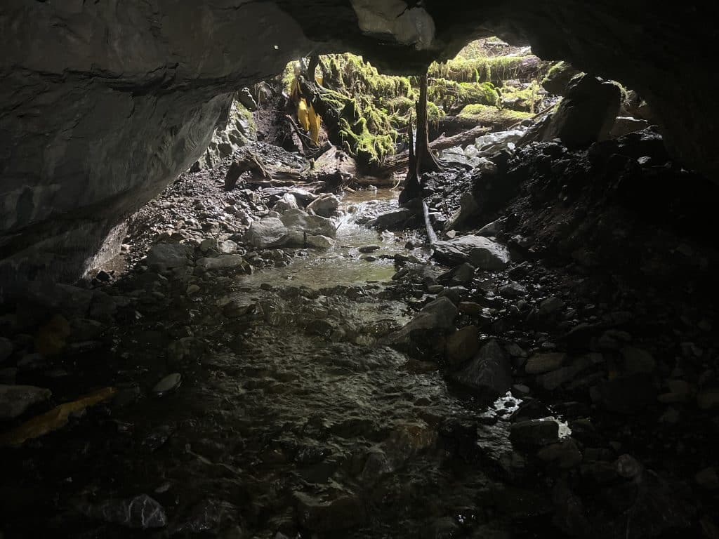
Impacts on Ecological and Microclimate Conditions
Karst environments support unique ecosystems, including cave-dependent species and microclimates near cave entrances. Disturbance can alter humidity, temperature, and nutrient inputs critical to subterranean ecosystems.
Maintaining stable microclimates and protecting karst-dependent flora and fauna is key to maintaining these ecosystems and promoting resilient forest ecosystems.
Our Field Approach
Karst assessment integrates geology, hydrology, and operational risk evaluation.
We conduct:
Each site is evaluated in the context of proposed activities—not just mapped features.
Flow Pathway & Sediment Risk Evaluation
Road construction and logging can alter water flow patterns.
We assess:
As with terrain stability, tables and distances alone do not define risk. Real-world site conditions inform our final calls.
Mitigation & Operational Controls
Where karst sensitivity exists, mitigation measures may include:
In-House Karst Expertise
Karst assessment requires specialized training and field experience. Melissa Dinsdale, P.Geo., leads karst work within Third Rock Geoscience.
Her background includes:
She brings both technical knowledge and field judgment to complex karst environments.
Bridging Industry and Cavers
Karst feature locations are sensitive, and information about them must be handled responsibly. At the same time, industry needs to protect operational planning details. Effective assessment requires navigating both sets of expectations with discretion and professionalism.
Melissa’s long-standing relationships within the caving community supports a more informed understanding of local systems while maintaining appropriate confidentiality.
Our reports provide clients with the information they need—without unnecessarily exposing sensitive locations.
What Clients Receive
A Karst Field Assessment typically includes:
Where appropriate, simplified mapping components are included to communicate constraints clearly while respecting information sensitivity.
Consistency from Field to Final
Karst assessments carry environmental and reputational implications.
Our field observations, summary recommendations, and final reports are aligned from start to finish.
All work is reviewed prior to release to ensure consistency, practical recommendations, and clear rationale .
Clients can rely on our calls.
Discuss Your Site
If your proposed operations intersect with carbonate bedrock (limestone, marble, or dolomite), early karst assessment reduces environmental risk, protects groundwater, and improves operational planning clarity.
Contact Third Rock Geoscience to start the conversation.
Specialized knowledge. Practical mitigation. Professional reporting.
